egeniouss Experts in Interviews: Achim Hennecke, Managing Director at beemo GmbH

Nuria Martínez (DEC Manager at CEL) asks: Can you explain in your own words, what the egeniouss base technology is (and how you use it in your app)? Achim Hennecke (Managing Director at beemo GmbH) answers: First of all, the egeniouss technology is a really exciting approach that we are currently researching and developing in the project. It involves an innovative method of drawing conclusions […]
How accurate do you think your smartphone’s location is under ideal conditions?

The answer is 5 to 10 m! The egeniouss project is crucial for enhancing geolocation accuracy and reliability. It is vital for applications requiring precise positioning, such as cycling, railway, urban planning, but also autonomous driving. , . Smartphone– based navigation generally provides location data with a range of 5 to 10 meters accuracy […]
Did you know that GPS is often referred to as the “Kleenex” of the GNSS “world”?
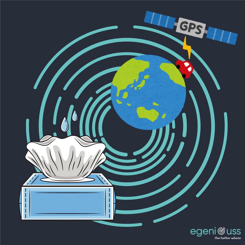
GPS is just one type of Global Navigation Satellite System (GNSS), similar to how Kleenex is one brand of tissue. Many people use the term “GPS” as a generic term for satellite navigation, but there are other GNSS systems like GLONASS, Galileo, and BeiDou. For more information about GNSS and its various systems, check […]
egeniouss Article: benefits for the logistics communities, by Joan Altimira (CATUAV)
CEL published in his latest magazine LogiCEL an insightful article by egeniouss partner Joan Altamira, UAV R+D & prototiping Engineer at CATUAV
Galileo
Galileo and EGNSS egeniouss relies on the European GNSS Galileo and its augmentations, such as the High Accuracy Service (HAS), as its backbone. egeniouss’ multi-sensor navigation system integrates code and carrier phase measurements, along with HAS, into a unified, general, and generic sensor-agnostic real-time trajectory determination module. This comprehensive integration ensures that egeniouss can provide […]
Interdisciplinarity
Interdisciplinarity Visual localisation is a cutting-edge technology that thrives on the dynamic interplay of multiple scientific disciplines. In egeniouss, experts from Computer Vision, Computer Science, Photogrammetry, and Geodesy collaborate closely to develop its sophisticated algorithmic foundation and innovative cloud solution. Computer Vision algorithms and neural networks enable egeniouss to understand and interpret intricate image details, […]
API
Platform Independence egeniouss is developed as an application-independent service, highly advantageous for a wide array of location-dependent or location-reliant applications. Designed with platform independence in mind, egeniouss is accessible through a versatile API, ensuring seamless deployment across various devices, including mobile phones, drones, and a wide range of robots. By leveraging the Robot Operating System […]
Cloud
Cloud egeniouss provides a robust cloud solution designed to ensure scalability, reliability, and high performance while managing extensive reference data. It also supports offline operation through caching when no internet connection is available. To enable the visual localisation service, image- and object-based reference data are stored in a cloud-based database. Our cloud infrastructure complies with […]
egeniouss Experts in Interviews: revolutionising the supply chain with Gisèle Muñoz, Innovation & Development Director at CEL

Nuria Martínez (DEC Manager at CEL) asks: Can you explain in your own words, what the egeniouss base technology is (and how you use it in your app)? Gisèle Muñoz (Innovation & Development Director at CEL) answers: egeniouss is a project that establishes a paradigm shift in positioning and navigation technology by integrating smartphone image […]
egeniouss Experts in Interviews: Increasing technical reputation with Johannes Hecher, Data Scientist at Crayon

Nuria Martínez (DEC Manager at CEL) asks: Can you explain in your own words, what the egeniouss base technology is (and how you use it in your app)? Johannes Hecher (Data Scientist at Crayon) answers: At its core, the base technology of a visual localization database involves capturing and storing key visual features from the […]